


apie de Raynaud forêt des arcs

clintest
User
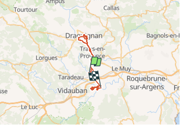

Length
51 km

Max alt
195 m

Uphill gradient
736 m
Km-Effort
61 km

Min alt
29 m

Downhill gradient
786 m
Boucle
No
Creation date :
2022-10-17 20:46:16.952
Updated on :
2022-10-22 18:07:20.748
27h20
Difficulty : Very difficult

FREE GPS app for hiking
 SityTrail
IGN / Geographical institutes
SityTrail Plus
The world is yours!
About
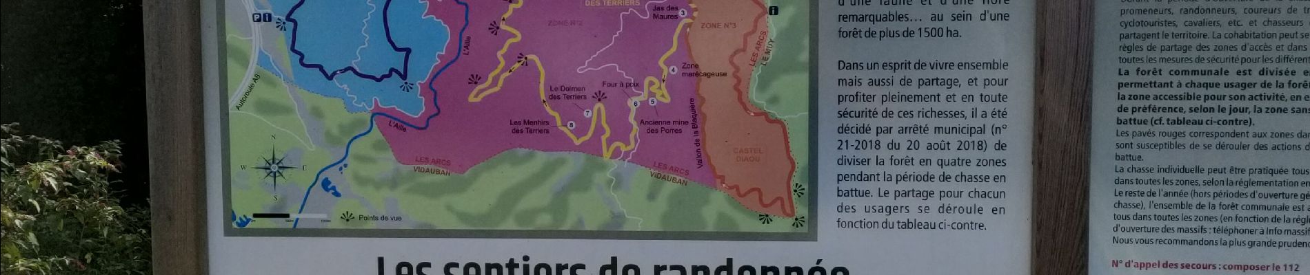
Trail Walking of 51 km to be discovered at Provence-Alpes-Côte d'Azur, Var, Les Arcs-sur-Argens. This trail is proposed by clintest.
Photos


Positioning
Country:
France
Region :
Provence-Alpes-Côte d'Azur
Department/Province :
Var
Municipality :
Les Arcs-sur-Argens
Location:
Unknown
Start:(Dec)
Start:(UTM)
295914 ; 4815341 (32T) N.
Comments